The Best Places for UK Short Breaks in 2025
If you've been wondering where the best place to for a weekend break in the UK is, then you're...
by Steph Boal / Travel Tips Walking
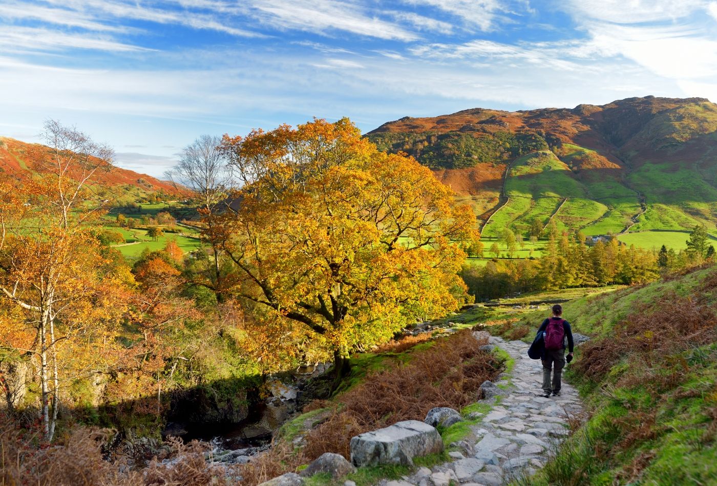
Embark on an enlightening journey through breath-taking landscapes by joining us as we explore the best walks in the UK.
From the rugged terrain of the Isle of Skye to the idyllic Cornish coast, our guide to the UK’s best walks promises endless natural wonders and cultural gems.
Looking for a collection of UK walks varying in difficulty? We’ve got you covered! From family-friendly trails for leisurly strolls to challenging hikes for seasoned hikers, there is something for everyone!
Ignite your wanderlust by reading on to find the best walks in the UK…
The UK is bursting at the seams with beautiful walks, which we have detailed below. In my opinion, the best place for walking in the UK is the Peak District.
However, the other great places for walking in the UK include the Lake District and the Cotswolds because of the sheer volume of walks through picturesque landscapes.
There are 16 complete National Trails in the UK. The King Charles III England Coast Path will be the 17th and the longest, upon its completion.
These National Trails can be found across England and Wales and are the equivalent of Scotland’s 29 Great Trails.
It is difficult to choose just one as all of the National Trails in the UK are breath-taking!
In my opinion, the most beautiful National Trail in the UK is the Cleveland Way National Trail. This stunning walk stretches 109 miles and merges the idyllic North York Moors countryside with unbeatable views across dramatic coastline.
Not only is the Cleveland Way the most beautiful National Trail in the UK, it is also one of the UK’s best walks. Read on to find more about it!
The longest walking path in the UK is the Land’s End to John o’Groats Walk.
Spanning 874 miles on road and 1,215 miles by path, this route can be far longer than The Wales Coast Path, which comes in at an impressive 870 miles.
However, when the England Coast Path is completed, this UK walk will be far longer than either trail. It is expected to stretch a whopping 2,795 miles!
The oldest long distance footpath is The Ridgeway, which stretches from Avebury to Goring for 87 miles.
This wonderful UK walk dates back more than 5000 years! It is believed that the path was initially over 30 miles long, linking the Dorset coast to the Norfolk coast.
Embark on this walk to experience epic views of chalk downland, as well as a plethora of historic monuments from the Stone, Bronze and Iron Ages.
If you’re a seasoned hiker looking to take on the the hardest walking trail in the UK, look no further than The Cape Wrath Trail in the Scottish Highlands or the Cullin Ridge Traverse on the Isle of Skye.
Both of these walks are at the mercy of the ever-changing weather in Scotland. With difficult crags and edges, high winds, steep drops and slippery slopes, it’s unsurprising that these walks are renowned for their difficulty.
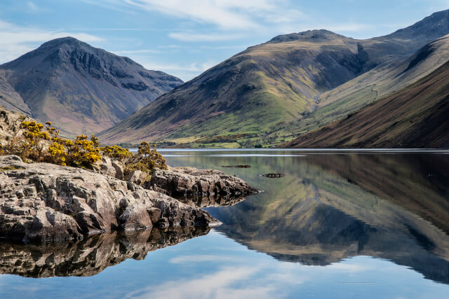
Kicking off our guide to the best walks in the UK is Scafell Pike in the Lake District. As England’s highest mountain, it is unsurprising that it has made our list.
The 8-mile hike up to the summit is breath-taking; admire far-reaching views across the picturesque vistas of the Lake District, into the Eskdale valley and over several other impressive Lake District mountains.
Begin your ascent in the Wasdale Head Green car park, where you can join the track leading to the farm at Burnthwaite. Once here, you can join the St Head bridleway and then the start of the Corridor Route.
The Corridor Route meanders upwards until you reach the southernside of Lingmell Col, where you can head left to reach the summit of Scafell Pike.
Impressive views across the Lake District reward you after this challenging walk. Take some time here to bask in nature’s beauty, before beginning the climb back down the mountain.
Distance: 8 miles
Difficulty: Hard
Suitable for: Adults and only dogs that are used to scrambling and uneven terrain
Start Point: Wasdale Head Green Car Park, 54.4652665, -3.2576067
End Point: Wasdale Head Green Car Park, 54.4652665, -3.2576067
Parking: Free parking on the green
Full route: Scafell Pike full route
Book a cottage near Scafell Pike today…
Cockley Beck Cottage (Ref. 914891) | 2 guests, 1 bedroom | 2 dogs | Cockley Beck near Broughton-in-Furness, Lake District
Yew Tree Cottage Borrowdale (Ref. 1041301) | 4 guests, 3 bedrooms | 2 dogs | Borrowdale, Lake District
The Old Barn (Ref. 973071) | 4 guests, 2 bedrooms | No pets | Gosforth, Lake District
The Vicarage (Ref. 1064519) | 8 guests, 4 bedrooms | No pets | Rosethwaite, Lake District
Browse the full list of Lake District cottages and book your getaway today!
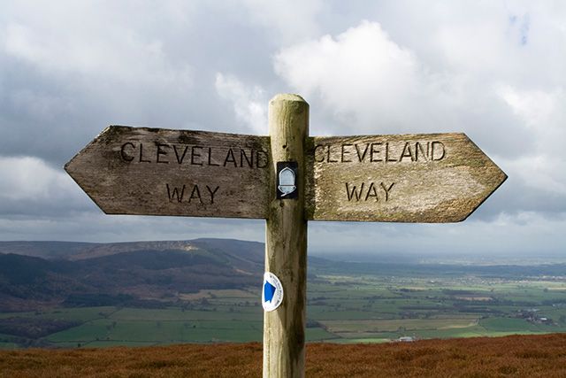
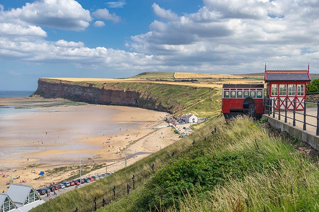

The Cleveland Way, in my opinion, is the most beautiful of all the UK National Trails! There was no way that it couldn’t not make our guide to the best UK walks, as it merges the finest aspects of North Yorkshire’s countryside and coast.
Beginning in the charming town of Helmsley, this stunning walk is a mammoth task for ramblers as it stretches 109 miles! Ending in Filey Brigg, this walk winds through heather moorland before merging with the coast. It can also be broken up into sections, but keen ramblers recommend setting aside around 10 days to complete the full trail.
Climbing out of the Rye Valley, you will pass the stunning ruins of Rievaulx Abbey, before beginning an amble along the limestone Hambleton Hills and the The Cleveland Hills. You will then reach Middlesbrough and Saltburn-by-the-Sea.
From here, breath-taking coastal views are in abundance as the walk meanders through idyllic coastal towns. Look forward to spending time in Whitby; uncover a wealth of literary history and indulge in some of the UK’s best fish and chips, before moving on to the picturesque fishing village of Robin Hood’s Bay.
This North Yorkshire walk then hugs the coast to reach the bustling seaside resort of Scarborough, which boasts swathes of golden sand and a famous cliff lift, before reaching its end point in Filey Brigg, a renowned haven for bird watchers.
Put your feet up and bask in the serenity of the coast after completing The Cleveland Way, one of the UK’s best walks!
Distance: 109 miles
Difficulty: Hard, however some sections of the walk are easy and accessible
Suitable for: Adults, however when broken into sections great for the whole family
Start Point: Hemsley Castle Car Park, 54.2462608, -1.0658238
End Point: The Stone Marker at Filey Brigg, 54.2172857,-0.2760609
Parking: There are pay and display car parks along the route
Full Route: Cleveland Way full route
Book a cottage near The Cleveland Way today…
Anvil Cottage (Ref.1064915) | 3 guests, 2 bedrooms | 1 dog | Kirkbymoorside, North York Moors
The Old Dairy (Ref. 1134525) | 4 guests, 2 bedrooms | 2 dogs | Sutton near Thirsk, North York Moors
Ryedale Country Lodges – Hazel Lodge (Ref. 1011649) | 5 guests, 3 bedrooms | 2 dogs | Kirkbymoorside, North York Moors
Castle View (Ref. 2779) | 8 guests, 4 bedrooms | 2 dogs | Helmsley near Kirkbymoorside, North York Moors
Take a look at the full list of North York Moors cottages to find your perfect break!
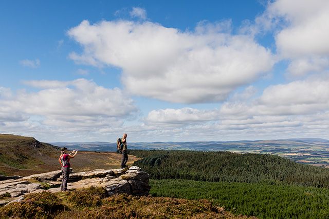
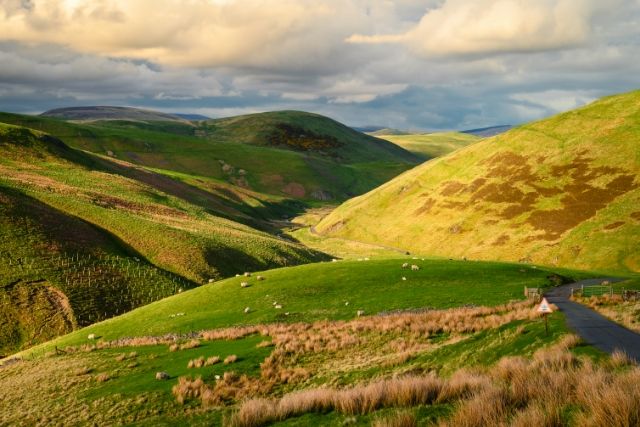

Aptly named, the Simonside Family Walk only measures 3 miles, making it one of the best UK walks for families. Nestled in the majestic Harwood Forest, you can look forward to losing yourself in nature on this UK walk.
Taking around 1.5 hours, begin the Simonside Family walk in the Simonside Car Park and follow the path as it meanders up into the trees. From here, you will pass a TV mast before venturing deeper into the forest. When you reach the edge of the trees you can admire the breath-taking views across the Coquet Valley towards the highest hill in Northumberland National Park, Cheviot.
Follow the path into the trees and keep the kids entertained by trying to identify the different tree species or by collecting bear cones dropping off the trees.
When you reach the path signposted for Little Church Rock, follow it to reach the rocky outcrop where if you’re feeling brave you can admire unbeatable views from the top of the rock. Be careful as this can be slippery when wet!
After soaking up the views, discover the heather-clad clearing, home to a burial cairn that was excavated in the 1890s. This piece of hidden history marks the beginning of your leisurely walk back to the car park.
Distance: 3 miles
Difficulty: Easy
Suitable for: Suitable for families and pets
Start Point: Simonside Car Park, 55.2960473, -1.9637832
End Point: Simonside Car Park, 55.2960473, -1.9637832
Parking: Free parking available
Full Route: Simonside Family Walk full route
Book a cottage near The Simonside Family Walk today…
Maple Tree Cottage (Ref. 1072928) | 3 guests, 2 bedrooms | No pets | Longframlington, Northumberland
The Granary (Ref. 1541) | 4 guests, 2 bedrooms | No pets | Longframlington, Northumberland
Coquet View Cottage (Ref. 1013620) | 6 guests, 3 bedrooms | 1 dog | Rothbury, Northumberland
Check out these other Northumberland cottages and begin your adventure today!
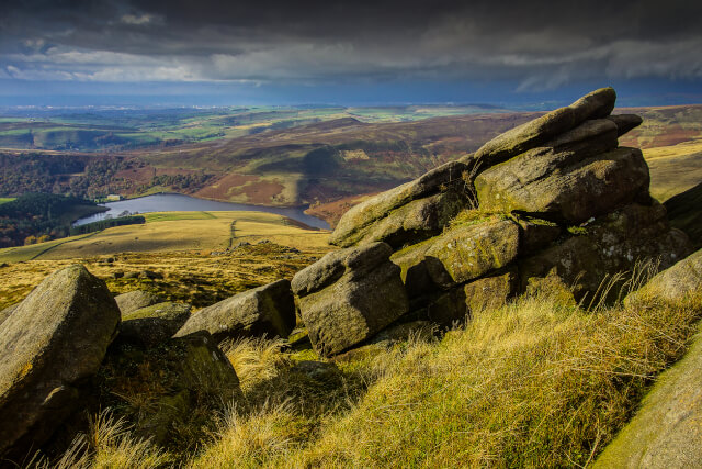
If you’re looking to lose yourself in the beauty of the Peak District, then the next entry in our guide to the best walks in the UK has you covered. The Edale to Kinder Scout circular walk begins in the village of Edale and climbs all the way to the summit of Kinder Scout, where beautiful views await.
Aimed at experienced hikers due to its rocky terrain, this UK walk begins and ends in the Edale village car park. When you’re ready to begin your adventure, head into the heart of the village to join the footpath signposted Grindsbrook.
Enjoy a spell of walking through fields and an area of woodland, before reaching a gate at the end of the wood. From here you will find moorland that leads into the steep ravine of Grindbrook Clough. This continues until you reach Crowden Tower and the stunning Wool Packs rock formations.
You will then reach Noe Stool, a large rock on the edge of the Kinder Plateau; spend time here admiring the views across the Peak District National Park, the ultimate reward for conquering one of the UK’s best walks. Parts of this walk are also suitable for those with dogs, perfect if you’re looking for a dog-friendly Peak District walk.
You can then begin your descent via an obvious fork in the road to Jacob’s Ladder, where you will find a path signposted back to Edale. When you reach the village, be sure to stop at The Old Nag’s Head pub for a well-earned drink!
Distance: 8 miles
Difficulty: Hard
Suitable for: Adults
Start Point: Edale village car park, 53.3646101, -1.8149478
End Point: Edale village car park, 53.3646101, -1.8149478
Parking: Pay and display parking in Edale village car park
Full Route: Kinder Scout full route
Book a cottage near Kinder Scout today…
Elderbank (Ref. 1609) | 2 guest, 1 bedroom | No pets | Bradwell near Castleton, Peak District
Millstream Cottage (Ref. 981405) | 4 guests, 2 bedrooms | No pets | Castleton, Peak District
Croft Cottage (Ref. 1057505) | 6 guests, 3 bedrooms | 2 dogs | Castleton, Peak District
Hope View House (Ref. 1131655) | 6 guests, 3 bedrooms | 2 dogs | Castleton, Peak District
Find your perfect break with these Peak District cottages.
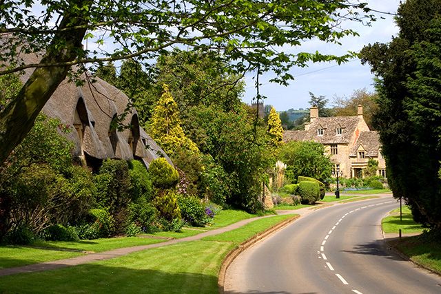

The Cotswold Way is undoubtedly one of the best walks in the UK, however, at a staggering 102 miles long, it might be ambitious for an evening’s ramble! That’s why we’ve chosen to feature the section of the Cotswold Way that runs from Chipping Campden to Dover’s Hill.
This magnificent UK walk is actually the first leg of the full Cotswold Way, but allows you to circle back. Taking between two-and-a-half and three-and-a-half hours to complete, it is the perfect choice for families or those looking to admire the beauty of the Cotswolds during a quick stroll.
Begin at the marker stone next to Market Hall in Chipping Campden. Follow the signposts for the Cotswold Way up Hoo Lane, onto Kingcomb Lane and then through a kissing gate onto Dover’s Hill.
Next, you can leave the Cotswold Way to follow the bridleway on the right, which meanders through a small woodland before reaching the left-hand kissing gate, which marks your ascent up Dover’s Hill.
Find a stone topograph at the summit and take a moment to admire the views from this natural amphitheatre that was once home to the English Olympic Games. Today, the annual ‘Cotswold Olimpicks‘ are still held here. When you’ve soaked in the beauty of the Cotswolds, retrace your steps to venture back to the village for a well-earned pint!
Distance: 4.5 miles
Difficulty: Moderate
Suitable for: Adults
Start Point: Market Hall, GL55 6AJ
End Point:Market Hall, GL55 6AJ
Parking: Free parking along the High Street and Back Ends in Chipping Campden, GL55 6AU
Full Route: Chipping Campden and Dovers Hill Full Route
Book a cottage near The Cotswold Way today…
Oma’s Cottage (Ref. 1094227) | 2 guests, 1 bedroom | No pets | Moreton-in-Marsh, Gloucestershire
Oakdene (Ref. 1072661) | 4 guests, 2 bedrooms | No pets | Upper Quinton, Warwickshire
Little Lamb Cottage (Ref. 1089552) | 4 guests, 2 bedrooms | No pets | Chipping Campden, Gloucestershire
Cotswold House (Ref. 988742) | 10 guests, 5 bedrooms | 1 dog | Moreton-in-Marsh, Gloucestershire
Begin your Cotswolds adventure by booking one of these cottages in the Cotswolds.
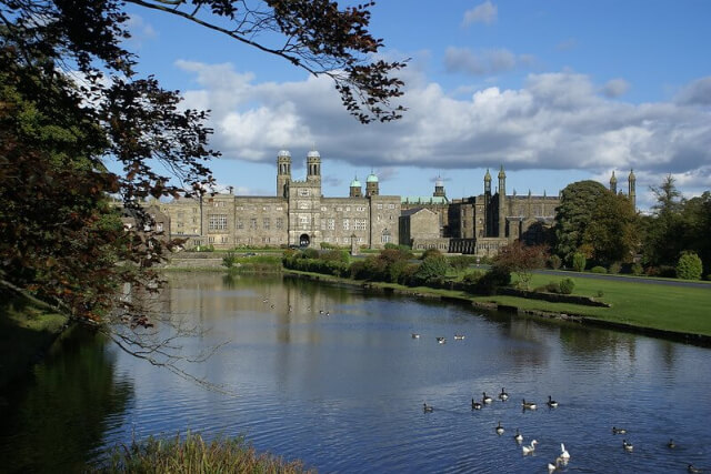
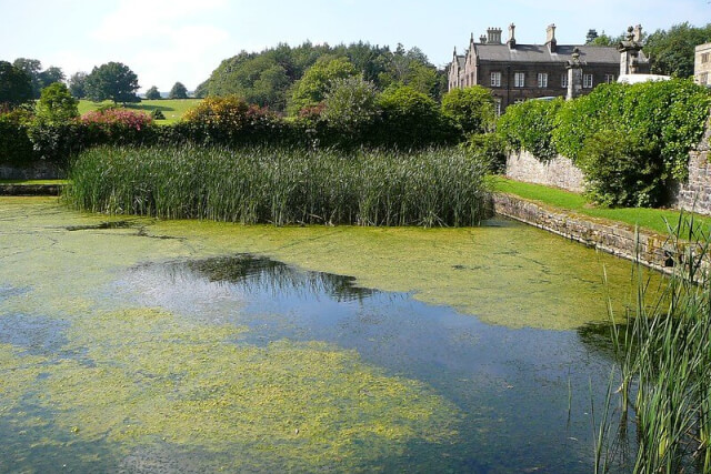
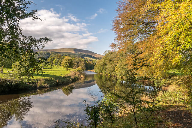
The next entry in our guide to the best UK walks will excite any fantasy lovers! Said to be the inspiration for one of the most popular franchises in the world, The Tolkien Trail allows you to walk in the author’s footsteps through Lancashire’s countryside.
The Lord of the Rings trilogy were published in 1954/1955 and have since become hugely popular worldwide. This walk attracts tourists from all over the world who are looking to see the inspiration behind their favourite fictional places.
J.R.R Tolkien was a frequent visitor to one of the guest houses in the grounds of the nearby Stonyhurst College and undoubtedly spent a lot of time writing here. In fact, the world of Lord of the Rings can be seen in real place names in this UK walk, including Shire Lane in Hurst Green. How many references can you spot?
The Tolkien trail meanders through Lancashire’s countryside, past Stonyhurst College and St Mary’s Hall, before following the curve of the River Hodder, which joins the River Ribble before returning you to the starting point at the Shireburn Arms Hotel, where you can refuel with delicious food, the perfect autumn walk!
Distance: 5.5 miles
Difficulty: Moderate
Suitable for: Adults
Start Point: Shireburn Arms Hotel and Restaurant, BB7 9QJ
End Point: Shireburn Arms Hotel and Restaurant, BB7 9QJ
Parking: Free on-street parking available on Avenue Road, opposite the pub.
Full Route: Tolkien Trail Full Route
Book a cottage near the Tolkien Trail today…
Park Brook Retreat (Ref. 951062) | 2 guests, 1 bedroom | No pets | Scorton, Lancashire
Springfield Cottage (Ref. 945252) | 6 guests, 3 bedrooms | 1 dog | Chipping, Lancashire
Meadowside Barn (Ref. 1101944) | 6 guests, 3 bedrooms | Wharles near Kirkham, Lancashire
Experience the beauty of the Tolkien Trail by booking a Lancashire cottage today!
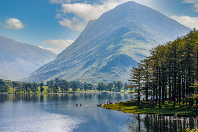
If you’re looking to experience the breath-taking beauty of the Lake District that inspired countless poets, then this next UK walk is perfect for you!
This 4.2 mile route follows a fairly flat and well-marked path that meanders around Buttermere Lake. With unbelievable views of The Sentinels, one of the country’s most photographed locations, and far-reaching vistas across the lake, it’s easy to see why Buttermere Lake is considered one of the best walks in the UK!
Begin your Lake District adventure at the Bridge Hotel in Buttermere. Follow the road to the left of the hotel down past the Buttermere Court Hotel and continue on this path as it winds through various National Trust fields and reaches the lake’s shore.
Admire stunning views over the water as you follow this 1.2-mile-long path, before reaching the end of the lake, where you turn left into Gatesgarth Farm. When you reach the road, take another left to join the path that curves around the opposite side of the lake. This takes you all the way back to the centre of Buttermere!
If you haven’t finished exploring, there are plenty of other Lake District walks to enjoy! And if you’re with your beloved pooch, you may want to tackle a few of the best dog-friendly Lake District walks.
Distance: 4.5 miles
Difficulty: Easy
Suitable for: Families and pets
Start Point: Bridge Hotel, Buttermere, CA13 9UZ
End Point: Bridge Hotel, Buttermere, CA13 9UZ
Parking: National Trust parking available nearby at CA13 9XA
Full Route: Buttermere Lake Full Route
Book a cottage near Buttermere Lake today…
Stone Ledges (Ref. 1110395) | 3 guests, 2 bedrooms | No pets | Keswick, Cumbria and the Lake District
Yew Tree Cottage Borrowdale (Ref. 1041301) | 4 guests, 3 bedrooms | 2 dogs | Borrowdale, Cumbria and the Lake District
Crow Cottage (Ref. 1041304) | 6 guests, 3 bedrooms | No pets | Keswick, Cumbria and the Lake District
Middletown (Ref. 1110390) | 8 guests, 4 bedrooms | No pets | Keswick, Cumbria and the Lake District
Begin your adventure around Buttermere by booking one of these Lake District cottages.
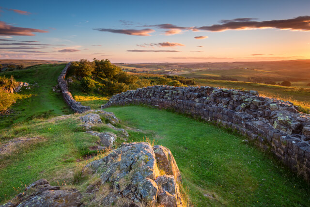
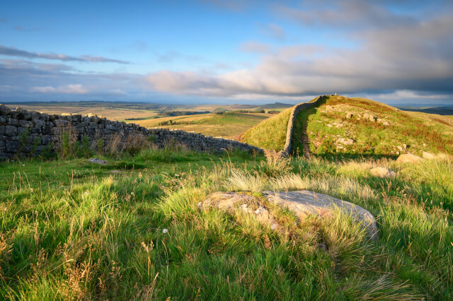

A section of the famous Hadrian’s Wall is next up on our walks guide! Combining history with panoramic views of Northumberland National Park, this UK walk is a must-do for keen ramblers.
Stretching over 84 miles, the full Hadrian’s Wall route is an ambitious challenge for even the most experience walkers. That’s why we’ve chosen a small section that encompasses some of the wall’s best preserved sections, as well as fantastic views, including those from the highest point of Hadrian’s Wall!
Taking around 4 hours, this walk begins at The Sill National Landscape Discovery Centre. Take the path on the right-hand side of the building and pass through a small woodland before meandering up the hill.
When you reach a sign, follow the path to the left, marked ‘National Trails, Caw Gap’ and stick to the grass path with Hadrian’s Wall to your right. The path slowly inclines to the trig point at the top of Winshield Crag. This is the highest point of the wall and provides panoramic views across Northumberland’s vast and beautiful countryside.
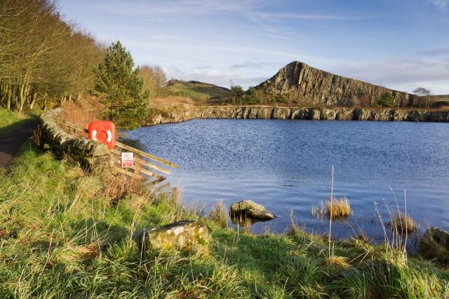
After taking a moment to savour the beauty, follow the path and head down the stone steps to a small road, which you can cross to reach a kissing gate. Continue following the path marked ‘National Trails/Cawfields’ Quarry for views over Cawfields Lake; a great place for a picnic!
When you’re done you can simply retrace your steps back to the car park or head to the nearby Housesteads Roman Fort to explore and perhaps join a guided tour.
Distance: 6 miles
Difficulty: Moderate
Suitable for: Adults
Start Point: The Sill: National Landscape Discovery Centre, NE47 7AN
End Point: The Sill: National Landscape Discovery Centre, NE47 7AN
Parking: Pay and Display parking available at The Sill, NE47 7AN
Full Route: Winshield Crags and Cawfields Full Route
Book a cottage near the Winshield Crag and Cawfields walk today…
Dove Cottage (Ref. 949797) | 2 guests, 1 bedroom | 2 dogs | Milton near Brampton, Cumbria and the Lake District
Chare Close Cottage (Ref. 906510) | 4 guests, 2 bedrooms | 2 dogs | Haltwhistle near Hadrian’s Wall, Northumberland
Herdwick Cottage (Ref. 1088093) | 5 guests, 3 bedrooms | No pets | Brampton, Cumbria and the Lake District
Pinegarth (Ref. 1132965) | 6 guests, 3 bedrooms | No pets | Catton near Allendale, Northumberland
Explore the beauty of this country by booking one of these Northumberland cottages!
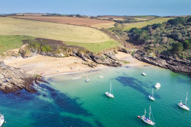
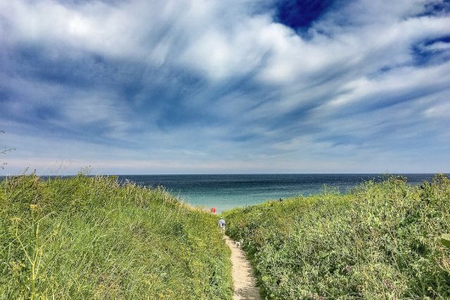
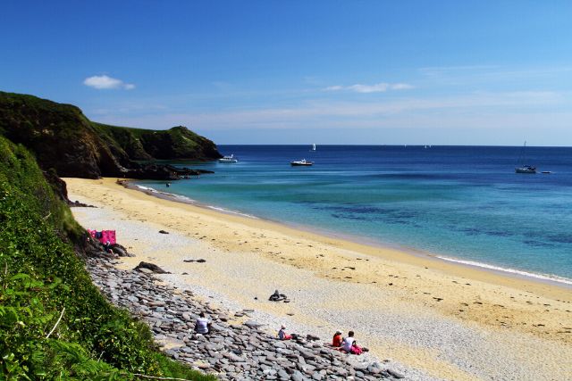
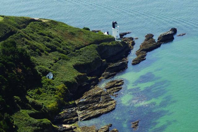
The Roseland Peninsula Creeks and Cliffs Walk is one of the more unique walks in our best walks guide. Featuring a ferry ride and stunning views across the English Channel, this UK walk is perfect for lovers of the coast!
This Cornwall walk actually begins in St Mawes, where you can can embark on an idyllic ferry ride across to the Roseland Peninsula. Stepping off the boat at the Place Ferry Jetty, you are greeted by the impressive Place House. Follow the road that hugs the coast before joining part of the South West Coast Path.
With views over the sea, Falmouth and St Mawes, the next section of the walk passes St Anthony Head and its impressive lighthouse! The path then continues until you reach the picturesque Porthbeor Beach, where you can descend 109 steps to spend some time on its sandy shores.
After some time on the beach or a quick dip in the sea, follow the path to Towan Beach and then head inland to Porth Car Park. Take a short walk through the woods, cross the bridge and follow the path alongside Porth Creek; this eventually meets the Percuil River, which takes you back to the Place Ferry Jetty.
It is worth noting that the ferry only runs between May and the end of October, however the walk is still accessible if you begin in the Porth Car Park. There are also plenty of other things to see and do near the Fal River!
Distance: 6 miles
Difficulty: Moderate to hard
Suitable for: Adults
Start Point: St Mawes Pier and Harbour, TR2 5DG. If you’re arriving by car, Porth Farm Car Park, TR2 5EX
End Point: St Mawes Pier and Harbour, TR2 5DG. If you’re arriving by car, Porth Farm Car Park, TR2 5EX
Parking: St Mawes Car Park, TR2 5DL or Porth Farm Car Park, TR2 5EX
Full Route: Roseland Peninsula Creeks and Cliffs Walk Full Route
Book a cottage near the Roseland Peninsula today…
Pier Cottage (Ref. 976458) | 4 guests, 2 bedrooms | 1 dog | St Mawes, Cornwall
Atlas House (Ref. 1137984) | 5 guests, 3 bedrooms | No pets | Falmouth, Cornwall
1 Florence Place (Ref. 976452) | 6 guests, 4 bedrooms | 2 dogs | Falmouth, Cornwall
16 Arwenack Street (Ref. 1071755) | 8 guests, 4 bedrooms | No pets | Falmouth, Cornwall
Book your getaway today after browsing the full list of Cornwall cottages!
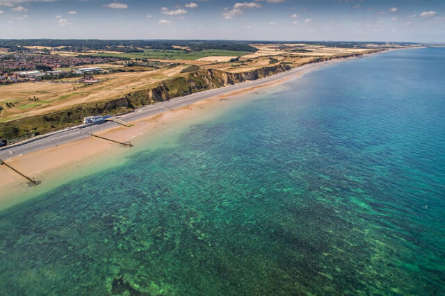

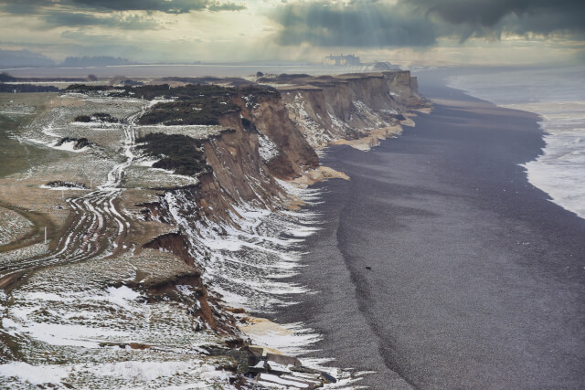
The Sheringham Circular Walk completes the England section of our guide to the best walks in the UK. Meandering through the idyllic seaside town of Sheringham, this delightful walk makes the most of Norfolk‘s countryside and coast.
Making a loop of about 7 miles, this wonderful UK walk begins at Sheringham Park Visitor Centre and winds through heathland and woods before reaching Weybourne Station.
From here, head towards the sea by following the road over the railway bridge into the quaint village of Weybourne. Pass the remains of Weybourne Priory, which date back to the 13th century, on Beach Road.
When you reach one of Norfolk’s best beaches, admire spectacular views across the sea before turning right onto the path that hugs the cliff edge. Breathe in the salty sea air and follow the path until you reach the next post, where you can turn right and cross the railway bridge.
This begins the route back to the visitor centre; don’t fret, there is plenty to see on the way! Stop at the Gazebo viewing platform and look out for the temple which stands in Sheringham Park.
Distance: 7
Difficulty: Moderate
Suitable for: Adults
Start Point: Sheringham Park Visitor Centre, NR26 8TL
End Point: Sheringham Park Visitor Centre, NR26 8TL
Parking: Pay and Display parking at Sheringham Park Visitor Centre, NR26 8TL (free for National Trust members)
Full Route: Sheringham Circular Walk Full Route
Book a cottage near the Sheringham Circular walk today…
Seaspray (Ref. 1128305) | 2 guests, 1 bedroom | 2 dogs | Sheringham, Norfolk
Megan Cottage (Ref. 1026466) | 4 guests, 2 bedrooms | No pets | Sheringham, Norfolk
8 Melinda Cottage (Ref. 1129307) | 5 guests, 3 bedrooms | 2 dogs | East Runton, Norfolk
Elliott’s Retreat (Ref. 992552) | 6 guests, 3 bedrooms | No pets | Sheringham, Norfolk
Secure your next adventure by booking one of these Norfolk cottages.
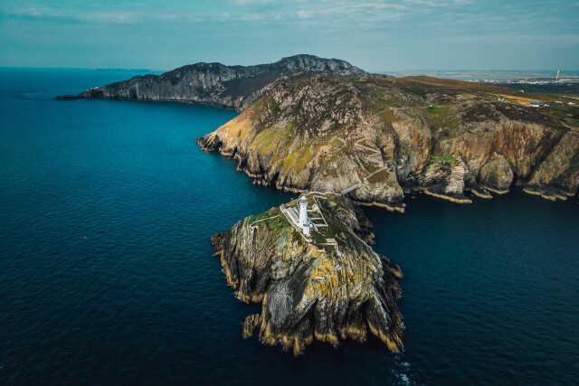

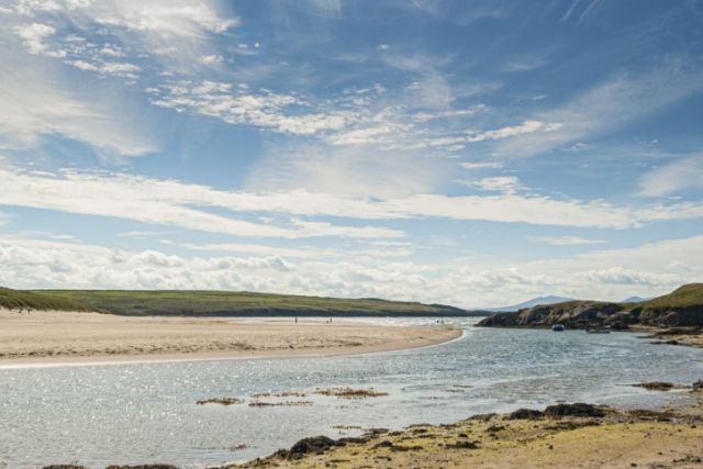
Kicking off the Wales section of our best walks guide is the Isle of Anglesey Coast Path. This mammoth walk is arguably one of the most picturesque, thanks to its endless sea views.
The path encompasses the entire island and stretches 130 miles! Taking around 14 days to complete, this UK walk is a challenge for even the most accomplished walkers. There is no pressure to complete the walk all in one go though, as it can be broken up into sections.
Although this walk in the UK can technically be started from anywhere on the route, the official starting point for the Isle of Anglesey Coast Path is Eglwys St Cybi (St Cybi’s Church) in Holyhead.
This UK walk lies in an Area of Outstanding Natural Beauty (AONB) that covers roughly 95% of the island, meaning you can look forward to some truly spectacular views. The Anglesey Coast Path weaves through coastal gems, including Cemaes, Amlwch, Moelfre and Aberffraw, which are home to some of the best North Wales beaches!
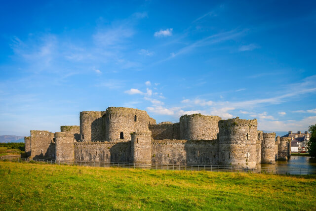
You can also uncover a wealth of history during your journey along the Anglesey Coast Path; winding through Beaumaris, you can take some time to explore one of the best Welsh castles: Beaumaris Castle. The start and end point of this iconic walk is also steeped in history; Eglwys St Cybi was founded in 540AD and lies in the walls of the Roman Fort, Caer Gybi.
Whether you choose to tackle all 130 miles, or just experience some of the sections, the Isle of Anglesey Coast Path is undoubtedly one of the UK’s best walks.
Distance: 130 miles
Difficulty: Hard, however some sections of the walk are more accessible
Suitable for: Adults, however some sections of the walk are suitable for families with children
Start Point: Eglwys St Cybi, Holyhead, LL65 1HG
End Point: Eglwys St Cybi, Holyhead, LL65 1HG
Parking: There are a number of pay and display car parks along the route. The whole route is possible to complete using public transport.
Full Route: Anglesey Coast Path Full Route
Book a cottage near the Anglesey Coast Path today…
Minnehaha (Ref. 1025821) | 2 guests, 1 bedroom | 1 dog | Moelfre, Anglesey
Min Y Traeth (Ref. 28035) | 4 guests, 2 bedrooms | No pets | Bull Bay, Anglesey
Ysgubor Newydd (Ref. 948316) | 4 guests, 2 bedrooms | 2 dogs | Llanbadrig near Cemaes Bay, Anglesey
The Headland (Ref. 1100140) | 7 guests, 3 bedrooms | 2 dogs | Llaneilian near Amlwch, Anglesey
Enjoy a getaway by the sea thanks to these coastal cottages in Anglesey.

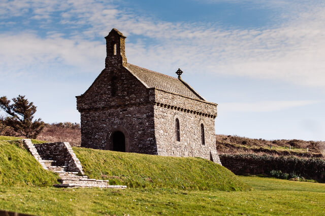

The next walk on our guide to the best walks in the UK is steeped in religious history. Forming part of the 186-mile Pembrokeshire Coast Path, this small section from Newgale to St Davids is a popular route for pilgrimages to St Davids Cathedral.
In 1123, Pope Callixtus II granted St Davids a privilege and declared that two pilgrimages to the cathedral were equal to one journey to Rome. This made it a hugely popular destination; a legacy that has remained today!
Regardless of your religious beliefs, this 13.5-mile walk, beginning next to Newgale Beach and ending in St Davids, is truly breath-taking. The route is also fairly easy to navigate as it follows the well signposted Pembrokeshire Coast Path.
Highlights of this UK walk include one of the best Pembrokeshire beaches, Newgale Beach, as well as Porthmynawyd Beach, the idyllic village of Solva, home of the Solva Lime Kilns, and of course St Davids Cathedral. You can also visit the Chapel of St Non, which is said to be the birthplace of St David, the patron saint of Wales.
After reaching your destination and soaking up beautiful views of the sea and rugged coastline, use public transport to begin your journey back to Newgale.
Distance: 13.5 miles
Difficulty: Hard
Suitable for: Adults
Start Point: Welsh Road Parking, Newgale, SA62 6AR
End Point: Oriel y Parc (St Davids Car Park, St Davids, SA62 6QT)
Parking: Welsh Road Parking, Newgale, SA62 6AR
Full Route: Newgale to St Davids Full Route
Book a cottage near the Newgale to St Davids walk today…
Post Office Cottage (Ref. 1099189) | 2 guests, 1 bedroom | 2 dogs | Trefesser, Strumble Head, Pembrokeshire
Inglenook Cottage (Ref. 1022862) | 4 guests, 2 bedrooms | No pets | Broad Haven, Pembrokeshire
Bramble Cottage (Ref. 993271) | 6 guests, 3 bedrooms | No pets | Newgale, Pembrokeshire
Primrose Cottage (Ref. 993484) | 6 guests, 4 bedrooms | No pets | Newgale, Pembrokeshire
Experience the best of Pembrokeshire’s stunning coast with these Newgale cottages.
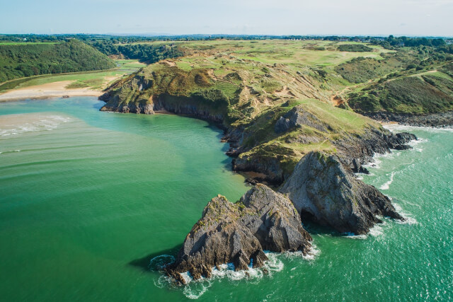
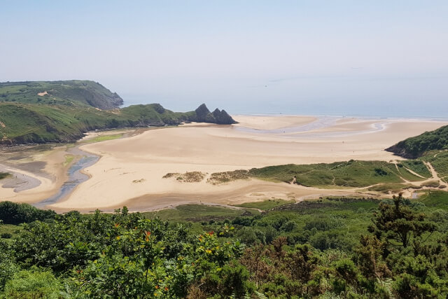
Nestled on the coast of the Gower Peninsula, the Three Cliffs Bay walk is a spectacular 6-mile-long walk with stunning views of the Bristol Channel and the iconic Three Cliffs.
Perfect for lovers of the sea, this UK walk begins in the National Trust Car Park of Southgate village. Follow the coastal path out of the car park to the rugged cliffs lining the peninsula. Keep your eyes peeled on this section as you can spot the Three Cliffs from Pebbles Bay Beach!
Follow the waymarks to find Pennard Castle, before crossing the footbridge over Pennard Pill. The path then skirts Northhill Wood before reaching Stepping Stones. This hidden beach is the perfect place to bask in the tranquility of the sea and admire the Three Cliffs protruding from the sea.
These iconic cliffs mark one of the most photographed areas in Gower and one of the best dog-friendly beaches in Wales. Perfect if you’re tackling this UK walk with your beloved pooch.
When you’re ready, continue with this UK walk by crossing the stepping stones again and following the coastal path back into the village of Southgate. Grab a coffee back at your starting location to toast the completion of this walk in the UK.
Distance: 6 miles
Difficulty: Moderate
Suitable for: Adults
Start Point: Three Cliffs Coffee Shop, Southgate, SA3, 2DH
End Point: Three Cliffs Coffee Shop, Southgate, SA3, 2DH
Parking: National Trust Car Park, Southgate, SA3 2AN
Full Route: Three Cliffs Bay Walk Full Route
Book a cottage near Three Cliffs Bay today…
1 Salt Cottage (Ref. 1102223) | 2 guests, 1 bedroom |3 dogs | Port Eynon, South Wales
The Stall (Ref. 20414) | 4 guests, 2 bedrooms | 2 dogs | Penuel near Llanmorlais, South Wales
The Dairy (Ref. 19775) | 4 guests, 2 bedrooms | 2 dogs | Penuel near Llanmorlais, South Wales
5 Chandlers Yard (Ref. 982375) | 8 guests, 4 bedrooms | 2 dogs | Burry Port, South Wales
Bask in the sea air of Three Cliffs Bay with a stay at one of these Gower cottages.

The UK’s highest mountain is the next entry in our guide to the best walks in the UK. The climb up Ben Nevis is arguably the hardest UK walk in our guide, but for keen hikers bagging this Munro is worth it!
Begin the challenging hike up this 4,413 foot Scottish mountain in the Ben Nevis Visitor Car Park and be sure to read all the signs at the visitor centre that detail precautions and necessary equipment. This is a popular route with tourists, so you will be joined by lots of other people eager to finish this amazing UK walk.
Cross the bridge over the River Nevis before turning right to follow the river bank. From here, you can follow the signs which lead to a stile, marking the beginning of the rising path. The path and route are well-marked and signposted. This, coupled with the breath-taking views up to the Mamories, Loch Meall an t-Suidhe and across the highlands, make this route one of the best walks in the UK.
When you eventually reach the summit spend some time basking in the impressive views! You might even spot a rock climber or two on the face of the mountain. When you’re ready, begin the descent to complete this walk, where a much-needed celebration is in order!
Distance: 10 miles
Difficulty: Hard
Suitable for: Adults
Start Point: Ben Nevis Visitor Car Park, 56.8099938,-5.0793709
End Point: Ben Nevis Visitor Car Park, 56.8099938,-5.0793709
Parking: Pay and Display parking available at Ben Nevis Visitor Car Park, 56.8099938,-5.0793709
Full Route: Ben Nevis Full Route
Book a cottage near Ben Nevis today…
The Garden Flat (Ref. 932724) | 2 guests, 1 bedroom | 2 dogs | Torlundy near Fort William, The Western Isles
Taorbeag at Taormina (Ref. 1098908) | 4 guests, 2 bedrooms | 1 dog | Banavie, Fort William, The Western Isles
Glen Nevis (Ref. 1013913) | 4 guests, 2 bedrooms | 2 dogs | Fort William, The Western Isles
Lochside, 1 The Corries (Ref. 1083346) | 6 guests, 3 bedrooms | No pets | Spean Bridge, Fort William, The Western Isles
Secure your getaway to Scotland with these Fort William cottages.
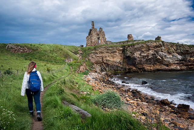

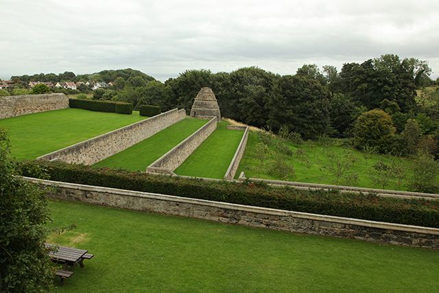
If you’re looking to experience the beauty of Scotland’s coast, this next UK walk could be perfect for you! With 116 miles of mesmerising coastal path, our guide to the best walks in the UK wouldn’t be complete with the Fife Coastal Path.
Don’t worry if you’re not ready to tackle this mammoth UK walk in one go, it can be broken down into 8 sections. However, if you’re feeling adventurous, set aside 8-10 days to fully appreciate the beauty of this walk.
A specially designed archway in Kincardine marks the start of this impressive walk. A matching arch can also be found at the walk’s end in Newburgh; a great place for a photo op when you’ve finished!
This spectacular Scottish walk meanders through countless picturesque coastal towns and villages: stop in Culross to admire the ruins of Culross Abbey or tour Culross Palace, spend time exploring Aberdour where you can tour Aberdour Castle and Garden, and delight in a day on the beach at one of the most popular beaches in Scotland, Aberdour Silver Sand.
Other stand-out places along this route include: Anstruther, Wormit and the University city of St Andrews, where you can step back in time with a tour of St Andrews Castle, St Andrews Cathedral and the Wardlaw Museum.
Distance: 10 miles
Difficulty: Hard, although some sections of the route are easier and more accessible
Suitable for: Adults, however some sections of the route are suitable for the whole family
Start Point: Fife Coastal Path Arch, Walker Street, Kincardine, 56.0660591,-3.7218118
End Point: Fife Coastal Path Arch, Newburgh Public Park, KY1 6DS
Parking: Pay and display parking available along the full route. Full route is accessible via public transport.
Full Route: Fife Coastal Path Full Route
Book a cottage near the Fife Coastal Path today…
Shortbreak Cottage (Ref. 1014109) | 2 guests, 1 bedroom | 1 dog | Newburgh, Fife
Eden Fields Lodge (Ref. 1134482) | 4 guests, 2 bedrooms | No pets | Cupar, Fife
Wonderland Cottage (Ref. 1069288) | 4 guests, 2 bedrooms | 1 dog | Newburgh, Fife
Bay View Cottage (Ref. 1001369) | 8 guests, 4 bedrooms | No pets | Wormit, Perthshire
Lose yourself in the beauty of Scotland by booking one of these Fife cottages.


The Glenfinnan Viaduct Trail is one of the shorter routes on our guide to the best UK walks. It may be short, but its beauty is unparalleled; it also features on many people’s UK bucket lists!
Begin your Scottish adventure in the car park, east of the River Finnan, where you can join the path that climbs up into the glen. You’ll soon be greeted with the majestic site of Glenfinnan Viaduct, which will be instantly recognisable as a Harry Potter filming location to eagle-eyed fans.
The path of this UK walk can be steep as it climbs up to a viewpoint that provides greater views over this monument. Visit between March and October to witness the Jacobite Steam Train, also known as the Hogwarts Express, as it crosses the viaduct and lets out its iconic puffs of smoke; the best autumn bucket list activity. Just makes sure you’re at this viewpoint at around 10:45am or 3pm.
After you’ve caught a glimpse of the train, continue your walk up the hillside to admire stunning views across Loch Shiel. Take in the view before heading downhill to pass through a tunnel, where the path passes Glenfinnan Station and its museum.
The next landmark you’ll see during this walk is the momument that was erected to commemorate Bonnie Prince Charlie’s role in the Jacobite rebellion. If you’re interested in learning more, you can end your walk at the National Trust Visitor Centre, before returning back to the car.
Distance: 2.5 miles
Difficulty: Easy to Moderate
Suitable for: Adults and families
Start Point: Community Car Park, Glenfinnan, PH37 4LT, 56.871100, -5.436400
End Point: Community Car Park, Glenfinnan, PH37 4LT, 56.871100, -5.436400
Parking: Pay and Display parking available at Community Car Park, PH37 4LT
Full Route: Glenfinnan Viaduct Trail Full Route
Book a cottage near the Glenfinnan Viaduct Trail today…
Little Tigh Clovelly (Ref. 1034630) | 2 guests, 1 bedroom | No pets | Spean Bridge, Fort William, Lochaber
The Garden Flat (Ref. 932724) | 2 guests, 1 bedroom | 2 dogs | Torlundy near Fort William, Lochaber
Glen Nevis Cottage (Ref. 1013913) | 4 guests, 2 bedrooms | 2 dogs | Fort William, Lochaber
Coire-Dhiubh (Ref. 1000346) | 6 guests, 3 bedrooms | 3 dogs | Glenfinnan, Fort William, Lochaber
Explore the rugged beauty of Scotland with these Scottish Highlands cottages.
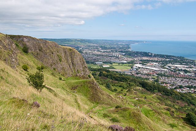
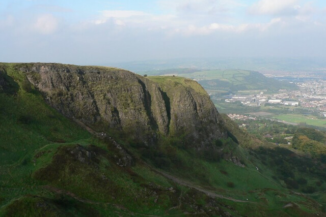
Cave Hill, an impressive landmark, stands proudly at 370 metres over Northern Ireland’s capital, Belfast. With panoramic views across the whole city, this UK walk is one to plan into your next visit to Belfast.
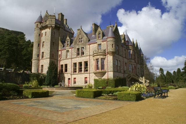
Forming part of the Belfast Hills, this wonderful walk begins in the car park of beautiful Belfast Castle. Admire the Castle’s exterior before passing through woodland, which leads to a path that follows the Devil’s Punchbowl.
Continue up this path as it winds to the summit; here you can find the ruined McArt’s Fort, as well as unbeatable views. Enjoy far-reaching vistas across the city; on a clear day the Isle of Man and Scotland can even be seen during this UK walk!
Once you’ve soaked up the views, begin descending down the south-facing slopes of Cave Hill. Impeccable views of the Black Mountains and even the Mourne Mountains can be seen in this section.
This path leads back to Belfast Castle, where you can end your walk with a a crisp pint in the Castle Tavern.
Distance: 4.5 miles
Difficulty: Moderate to Hard
Suitable for: Adults and families
Start Point: Belfast Castle Car Park 2, BT15 5GR
End Point: Belfast Castle Car Park 2, BT15 5GR
Parking: Pay and Display parking available at Belfast Castle Car Park 2, BT15 5GR
Full Route: Cave Hill Trail Full Route
Book a cottage near Cave Hill today…
Hallmount Cottage (Ref. 937120) | 3 guests, 2 bedrooms | No pets | Belfast, County Antrim
Lough Mill House (Ref. 1098967) | 4 guests, 2 bedrooms | No pets | Newtownabbey, County Antrim
Number 91 (Ref. 1081355) | 5 guests, 3 bedrooms | 1 dog | Belfast, County Antrim
Delight in this scenic walk with a stay at one of these Belfast cottages.

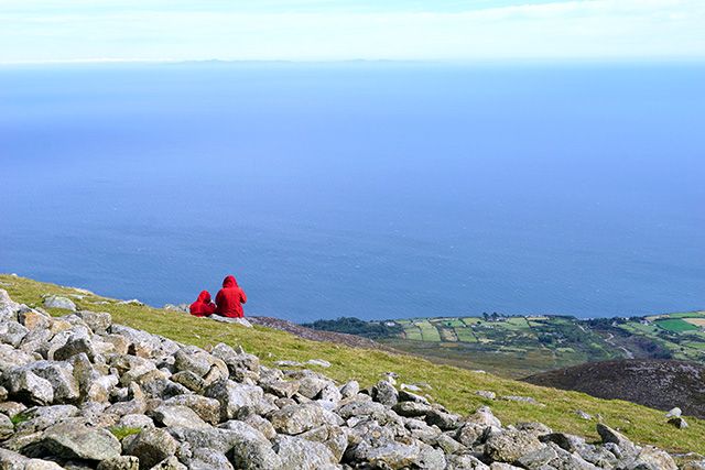
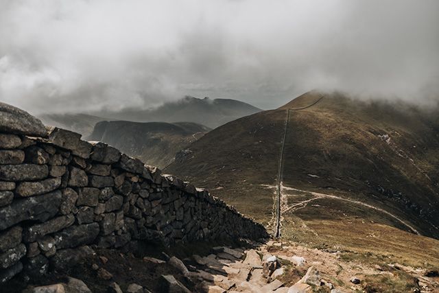
If you’re looking for your next exhilarating adventure in Northern Ireland, this UK walk is the perfect challenge. As the highest mountain in Northern Ireland, the views from the summit are unbeatable.
Part of the famous Mourne Mountains in the Mourne AONB, this walk is perfect for those looking for their next challenge. Beginning in a car park in Newcastle, the path meanders along the Glen River, before winding through dense forest.
Soak in the serenity of the forest before crossing a bridge to continue on the path as it begins to climb. The forest path ends and joins the rugged terrain that ascends into the mountains. Cross the next stile to reach the Saddle and Mourne Wall.
This section can be steep, so take care. However, the walk is worth it as the summit should be in sight. Enjoy panoramic views from the top; be sure to pack your favourite snack so your can savour it from atop Northern Ireland’s highest mountain.
Distance: 2.9 miles
Difficulty: Moderate to Hard
Suitable for: Adults
Start Point: 5 Donard Park Car Park, Newcastle, BT33 0HL
End Point: 5 Donard Park Car Park, Newcastle, BT33 0HL
Parking: Pay and Display parking available at 5 Donard Park Car Park, Newcastle, BT33 0HL
Full Route: Sileve Donard Full Route
Book a cottage near Sileve Donard today…
Lough Island Reavy Cottage (Ref. 1011860) | 2 guests, 1 bedroom | No pets, Kilcoo County Down
Scarvagh House (Ref. 1109614) | 4 guests, 2 bedrooms | No pets | Scarva near Loughbrickland, County Down
Book your getaway in Northern Ireland today with these County Down cottages.

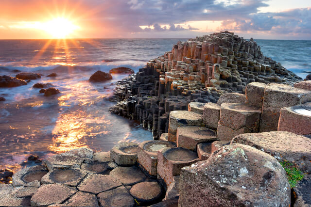
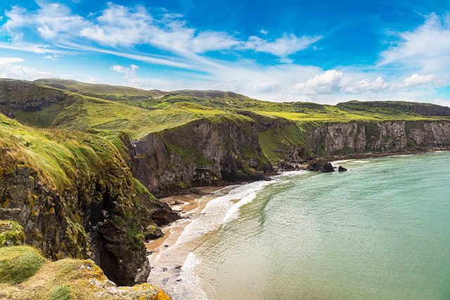
The final walk on our guide to the best walks in the UK is one of the best! Taking in a UNESCO World Heritage Site and another of Northern Ireland’s most popular attractions, the Carrick-a-Rede to Giant’s Causeway walk is a great way to explore.
You can follow this route in both directions, with either Carrick-a-Rede or the Giant’s Causeway as your starting point. You can also avoid walking the whole 20 miles by taking the bus back to wherever you choose to start.
We think Carrick-a-Rede is the best place to start; we’d also recommend doing the walk across the iconic rope bridge before you embark on your journey. After completing this daring attraction, follow the coastal path and bask in the impressive views until you reach Larrybane.
This spot might be recognisable to Game of Thrones fans as the filming location for The Stormlands. Continue on the coastal path and enjoy other highlights. including Ballintoy Harbour, White Park Bay and the ruins of Dunseverick Castle.
After around 10 miles, this UK walk eventually delivers the awe-inspiring Giant’s Causeway. By this time the crowds should have died down, so you’ll be free to explore the hexagonal, basalt columns and to learn about the legend of Irish giant, Finn McCool.
Distance: 10 miles
Difficulty: Moderate to Hard
Suitable for: Adults
Start Point: Carrick-a-Rede Car Park, 55.239796, -6.349012
End Point: Giant’s Causeway, BT57 8SU
Parking: National Trust Car Park at Carrick-a-Rede, 55.239796, -6.349012. Free for members, pay and display otherwise. Public transport can bring you back to Carrick-a-Rede.
Full Route: Carrick-a-Rede to Giant’s Causeway Full Route
Book a cottage near the Giant’s Causeway to Carrick-a-Rede walk today…
Woodleigh Cottage (Ref. 998119) | 4 guests, 2 bedrooms | No pets | Ballycastle, County Antrim
Alken Cabin (Ref. 1004376) | 5 guests, 2 bedrooms | No pets | Bushmills, County Antrim
Beachcomber (Ref. 1067997) | 6 guests, 3 bedrooms | No pets | Ballycastle, County Antrim
Explore Northern Ireland’s coast with these Ballycastle cottages.
Feeling inspired by our guide to the best walks in the UK? Get walking by booking one of these UK cottages! Check out our UK travel guide for more holiday inspiration.
Image Credits: Henry Brett – (CC BY 2.0); Pat Neary – (CC BY-SA 2.0); Matthew Hartley – (CC BY-SA 2.0); Alistair Young – (CC BY 2.0)
by Steph Boal / Travel Tips Walking
Hi, I'm Steph and I joined the Sykes team in 2022. I grew up in the North East of England so unsurprisingly I love exploring the w...
Read More About Author
Sign up to receive exclusive offers, competitions and the latest news to your inbox, and you'll be entered into our monthly prize-draw 3 times!

If you've been wondering where the best place to for a weekend break in the UK is, then you're...

Trying to find the perfect place to spend your next big staycation? If so, then you’ve come to the...

If you are looking for the best city breaks in the UK for 2025, we have collated 14 of...
Sign up to receive discounts, exclusive offers, travel tips and guides. We'll also enter you into monthly Prize draw. T&Cs apply. View Privacy Policy.
Are you on the phone to our call centre? Your Customer ID is:

Get involved in the Discussion